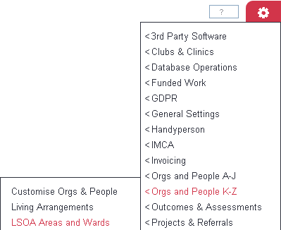
LSOA Areas and Wards
From Charitylog Manual
Introduction
The LSOA Areas and Wards feature acts as a lookup table and allows:
- to look up address data to be entered on organisation/people records (address lines 3,4 (Town), 5 (County) and Postal District. This can be done with full postcodes or partial postcodes. The lookup will check the table for an exact match on the postcode, if a match is found it will complete the relevant fields from the table. If a match is not found it will remove the last digit and research, this will continue until the final character is left. If no results are found then the fields will not be completed on the record.
- to attach local information when exporting data to a spread sheet (recommended that full postcodes are used for this data;
- Output Area Code
- Lower Output Area Code
- Wards
- Locality
- Local Authority
- Parish
- Clinical Commissioning Group
Adding/Editing
To edit an existing postcode click on the 'edit' button, or to add a new set of data click the 'Create new area' button.
Complete the following;
- Postcode (required)
Org/Person Record Fields
The following fields are optional, these are used to fill in the address details on the records;
- Address Line 3
- Address Line 4 (Town)
- Address Line 5 (County)
- Postal District
Reporting Fields
The following fields are optional, these are added to data extracted from reports, when specified;
- Output Area Code
- Lower Output Area Code
- Wards
- Locality
- Local Authority
- Parish
- Clinical Commissioning Group

